TopoBathySim

Contents:

  • Vision
  • Fusion Policy DSL
  • Policy Walkthrough
  • Runtime Architecture
  • Data Sources & Acknowledgements
  • Runtime Engine
  • Policy Schema
  • Providers
  • CLI Tools
  • Performance notes
TopoBathySim
  • TopoBathySim
  • View page source

TopoBathySim

TopoBathySim is a policy-driven fusion runtime for seamless topobathymetric data products.
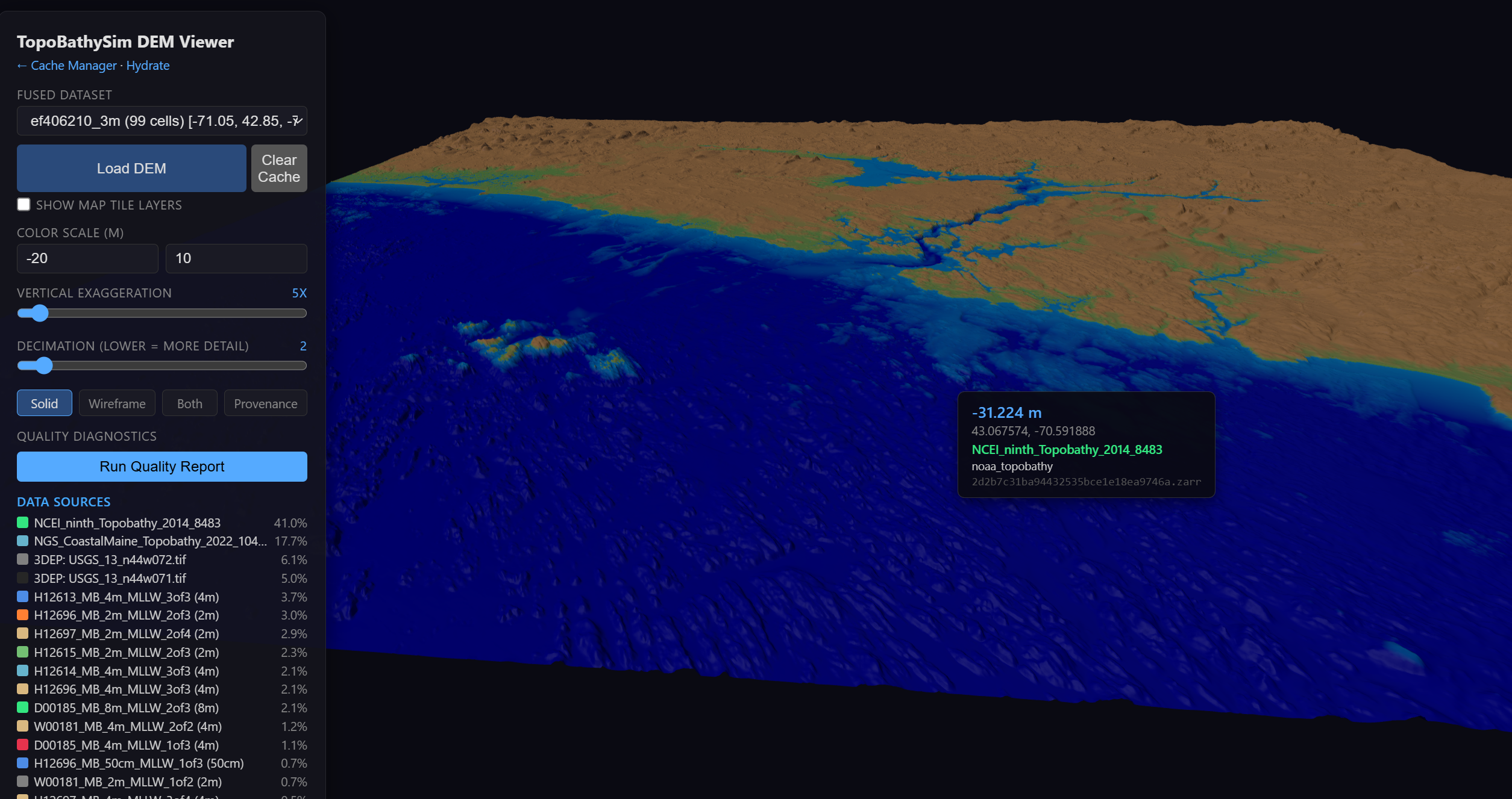
TopoBathySim Screenshot

Contents:

  • Vision
    • Mission
    • What TopoBathySim is
    • What TopoBathySim is not
    • Where we fit in the open topo/bathy ecosystem
    • Principles
    • How to contribute (most valuable paths)
  • Fusion Policy DSL
    • Structure
    • Variables
    • Composition Steps
    • Operators
    • Topologies (Transition Rules)
  • Policy Walkthrough
    • 1. Simple Fusion: Great Barrier Reef
    • 2. Complex Fusion: US Coastal (WLIS)
  • Runtime Architecture
    • Core Concept
    • Components
    • Provenance System
    • Caching Strategy
  • Data Sources & Acknowledgements
    • Global Coverage (Tier 4)
    • Continental / Land (Tier 3.5)
    • Regional Bathymetry (Tier 3)
    • Regional High-Resolution (Tier 2)
    • Local High-Resolution Lidar (Tier 1)
    • Survey “Truth” Data (Tier 0)
  • Runtime Engine
  • Policy Schema
  • Providers
  • CLI Tools
    • Understanding the Cache Hierarchy
    • Cache Manager
    • Server Management
  • Performance notes
    • Reference development machines
    • Practical guidance

Indices and tables

  • Index

  • Module Index

  • Search Page

Next

© Copyright 2025, WHOI Marine Predators Group.

Built with Sphinx using a theme provided by Read the Docs.